That trip resulted in me driving 300 miles up and back from the Bronx (and subsequently paying $11.00 in tolls) and around the Catskills without finding a single hiking trail, although the foliage was nice and I did get to eat lunch by a pleasant stream. As soon as I got home I went online and purchased several guide books to the Catskills, southern New York hiking and some other books, so as to never repeat that particular experience again.
So this time, armed with a number of maps, guide books, more careful preparation and more equipment, I woke up around 7 and hustled off to the Catskills for my first successful out of the city adventure. Everything had been prepared the night before, from my bagel sandwich to my pile of winter and rain clothes, so I was out the door by eight and driving up I-87 by nine. Now, in my non-east coast experience, Interstates are massive federally run freeways that allow the general public the freedom to move around this fabulous country of ours. On the East coast, this is untrue. Roads coast money, apparently more money in the East than in the West (reasonably this might be due to the snow or rain or whatnot) and you have to cover it when you drive on them ... this is what I thought taxes and all that extra national security money was for.
 I get to the Catskills around 10 and after wandering up the wrong trail about 10 minutes, I realize where I am and reverse myself, crossing a creek
and getting on the right trail, the Cornell-Wittenberg-Slide trail, around 11ish. This trail is named for the three peaks it passes over, and I am figuring it and the extra Giant path loop that will bring me back to the parking lot are about 10 miles around. Its a beautiful day up here, red and yellow leaves scattered all over the ground, crisp and clean air, with wide blue skies and a nice light wind.
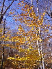 And is 45 degrees, I begin to realize with chagrin about the same time I regret wearing my shorts rather than my zip-off pants. Still, I figure I have got rain pants and long underwear and if it gets truly cold.
I hustle a bit to warm up and find myself passing a number of folks, and I get a hint of pride in my fitness and hiking ability. "I love how good at this I am" I think to myself ... and then stop in astonishment as the trail vanishes. I stand around like an idiot for a while until the people I pass pass me again and I notice all the tiny little trail markers, literally the only sign that the route I am on is a trail. Within the next half mile the trail becomes simply a sea of leaves, then a pond, then a rivulet, then a pile of rocks, but at no point does it resemble a trail.

Hiking here requires a bit more alertness than I am used to, like playing a game of treasure hunt except that the reward is that you don't get lost and freeze to death. So I continued apace, chatting my way up the trail. After meeting a large number of concerned Northeasterners, all of whom were friendly, helpful, convinced that this was a great first hike in the Catskills and concerned for my life, I finally had to start being a bit brusque and just nodding hello as I passed, otherwise I was never going to get anywhere. Admittedly, i was also tired of explaining that I was from California and an experienced hiker, as most people that saw me assumed I was 1) a lunatic or someone lacking a lower nervous system and 2) going to die out here because I obviously did not know what I was about. Telling them I was from the Golden State explained most it, as I have mentioned before, we in the Golden State are widely considered to be another, fully insane, form of life.
An hour later its truly cold. At around 3500 feet, not even really elevation by California standards, its freezing. Literally, there are icicles hanging from the rocks
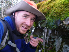 and snow all over the ground. Mark the very nice, very experienced hiker I met about half an hour before, who told me that the loop I was going to do was 15 miles and not 10, and who was sure I could get through it with only an hour or so of hiking in the dark, mentioned that there was a little sugar on the peak. On the peak. That's up at 3800 feet. I am down at 3500, so cold that I strip down in the middle of the trail to put on long underwear for the rest of the day.
 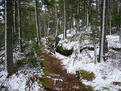 At this point, despite not wanting to slow down to talk to anyone, I made an exception to chat with the two cute neurobiology grad students from Syracuse who ran into me while I was changing, making for an interesting and slightly awkward introduction. We chatted for a bit and then I was on my way, onward and upward as they say. It was at this point that the trail became completely ridiculous. Not only was it snowy and icy at such a low elevation, it went through walls. Literally. I would round a bend and the trail markers would disappear, reappearing 25 feet above me on top of an icy wall of rock, or some precarious ledge or some other non-trail like feature of the land.
  Wittenberg-Cornell-Slide Trail" height="180" width="240">
It actually made for an incredible climb up, super fun and really rather strenuous, at least at the speed I was trying to move at. When I finally made it to the top of Wittenberg, the first of the three "mountains" I was climbing, as they were all under 4200' but were still serious elevation gain. They view was spectacular, actually the best I was going to get all day, taking in a lot of southern New York, with a beautiful view of the south-eastern Catskills surrounding
the Ashsokan reservoir.Wonderful.

They next 5 miles were fabulous, empty and really tough. I was never again privy to such wonderful views, although views off the backsides of Mt. Cornell and Slide mountain did provide excellent views of Wittenberg and then Cornell, as well as the rest of the Slide Mountain Wilderness, up toward the center of the Catskills. The trail was very rough, climbing over rock piles and across small rivers, down through snow-covered trees and along several icy, rock ledges and generally up, over and across things that had no right to be called trails.

Exhilarating. I loved it. From Wittenberg I went down 600 feet, then back up 600 feet to Cornells summit. This ascent was very windy and the climb was hard because my fingers were so cold, but by the time I got to the top the climb had warmed me. Then back down 700 feet, eating lunch on the way, and up 900 more to the top of slide mountain. Slide was cold and snowy and required the most climbing, but there were some ladders for the most hard-core sections.
 Finally, I reached the top, through a good deal of snow and ice. No view to speak of, but a nice plaque and a big ass rock that you could have a nice picnic on if you wanted to. Posed in triumph at the top
 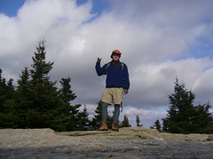 and then hustled off the mountain, down about 3 miles to the parking area ... at least I though it was the parking area.
I actually got lost and had to ford two large streams to end up in the private parking lot of a private resort on Lake Winnisook.
 Still, it was a shortcut and the day was fading so I moved quickly through the lot, and up the road to the Giant Ledge parking lot. In the distance I saw a port-a-potty, very exciting to me at this point, and moved quickly to reach it, only to find it was locked. Very disappointing.
I moved quickly across the giant ledge trail, at least until the sun started to set, when the fading light illuminated the forest in such a way that it looked like the trees were on fire.
 There might not have been that many colors, but the reds, oranges, yellows and purples made it seem like the sunlight was wet paint, dribbling onto the leaves and across the ground. Just spectacular ... and endless, as the colors continued the length of the path. After about 3 miles the path disappeared again, only the interference of another set of hikers kept me from being lost and led me to the massive rockslide posing as the last section of trail.
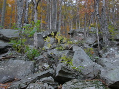 I climbed it slowly, this is 14.5 miles in mind you, and wearily ascended the last rise, looking back at the colored forest below, and dropped down to my car in the fading light. There was just enough to see without a headlamp ... just under 7 hours for the whole trip ... absolutely wonderful. Matilda awaited me happily. I got back, stripped off my sweat soaked outer layers and got in for the long drive back to the Bronx.
Great day.
To see all the pictures of this hike, go to http://www.flickr.com/photos/pjgaskill/sets/72157594339649015/

No comments:
Post a Comment