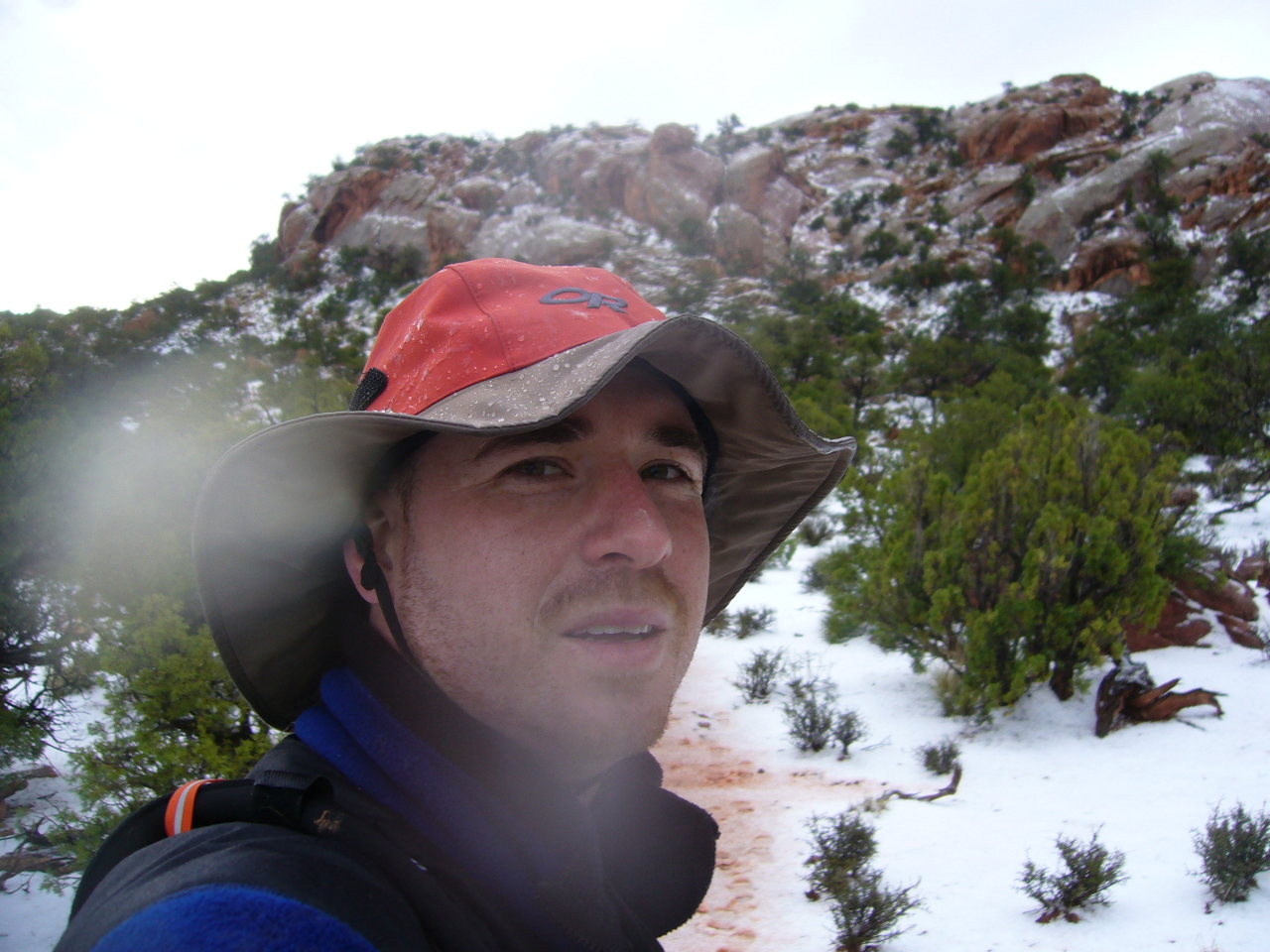
 As we are driving up Graves Creek Road
 to the trail head where we will start our hike, Neal explains that in the term tropical
rain forest, the first section of the phrase refers to temperature, while the second refers to level of precipitation. This insight is of particular import, as we are about to spend 3 days hiking through a temperate rain forest, and only in this time of relatively untouched and fertile area are you going to find trees big enough to do this in.
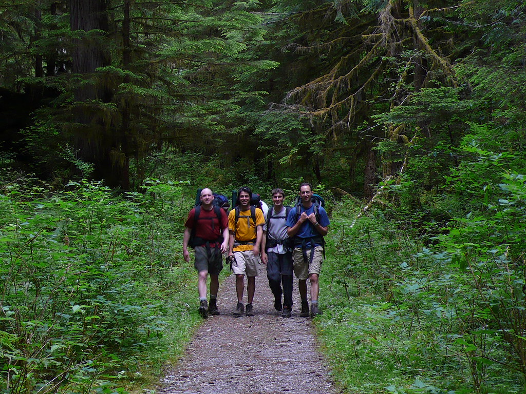
 But first things first. I arrived in Seattle
 the Friday night, having almost
killed myself getting here. Met up with Neal and Dave at the airport, and soon Matt came by in a supremely welcome sight, his brothers jeep Cherokee. The idea of spending 3-4 hours driving out to
Olympic National Park with 4 guys and all of our gear stuck in Matts tiny jeep had been something I was dreading. Food shopping (we brought entirely too much food, easily enough for 6 people), a fair nights sleep
and a few cups of coffee (none for me but hey, this is Seattle) later, we are on the road to Olympic. We went south on 5 until we hit 101, then followed in through Aberdeen and up to Quinault around 1 pm. Wilderness passes at the
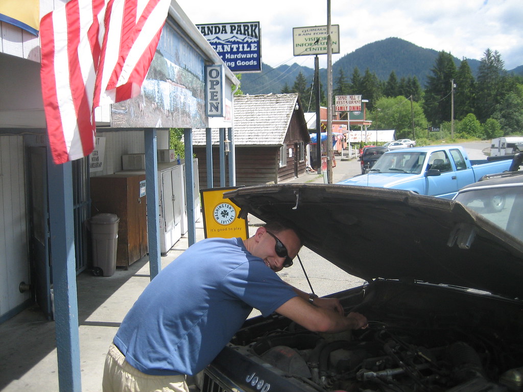
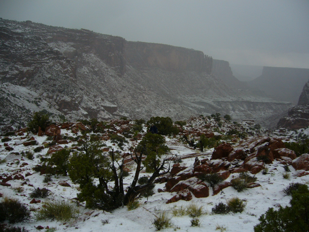
ranger station (for a nominal fee), and conformation that the snow situation in the park was truly as gnarly as we had heard. The Olympics get over 100 feet of snow per year and even in late June all the passes above 4000' were covered in snow at which Neal proclaimed the place the himalympics. Headed over to Amanda Park, got some fishing catch cards (which we were never to use) and Dave did some minor car repairs (old Sassie was tough, but with 200,000 miles and a 500$ price tag a little damage could be expected). Then back into the park, skidding our way along the muddy road up to Graves Creek trail head to start out to
Enchanted Valley.
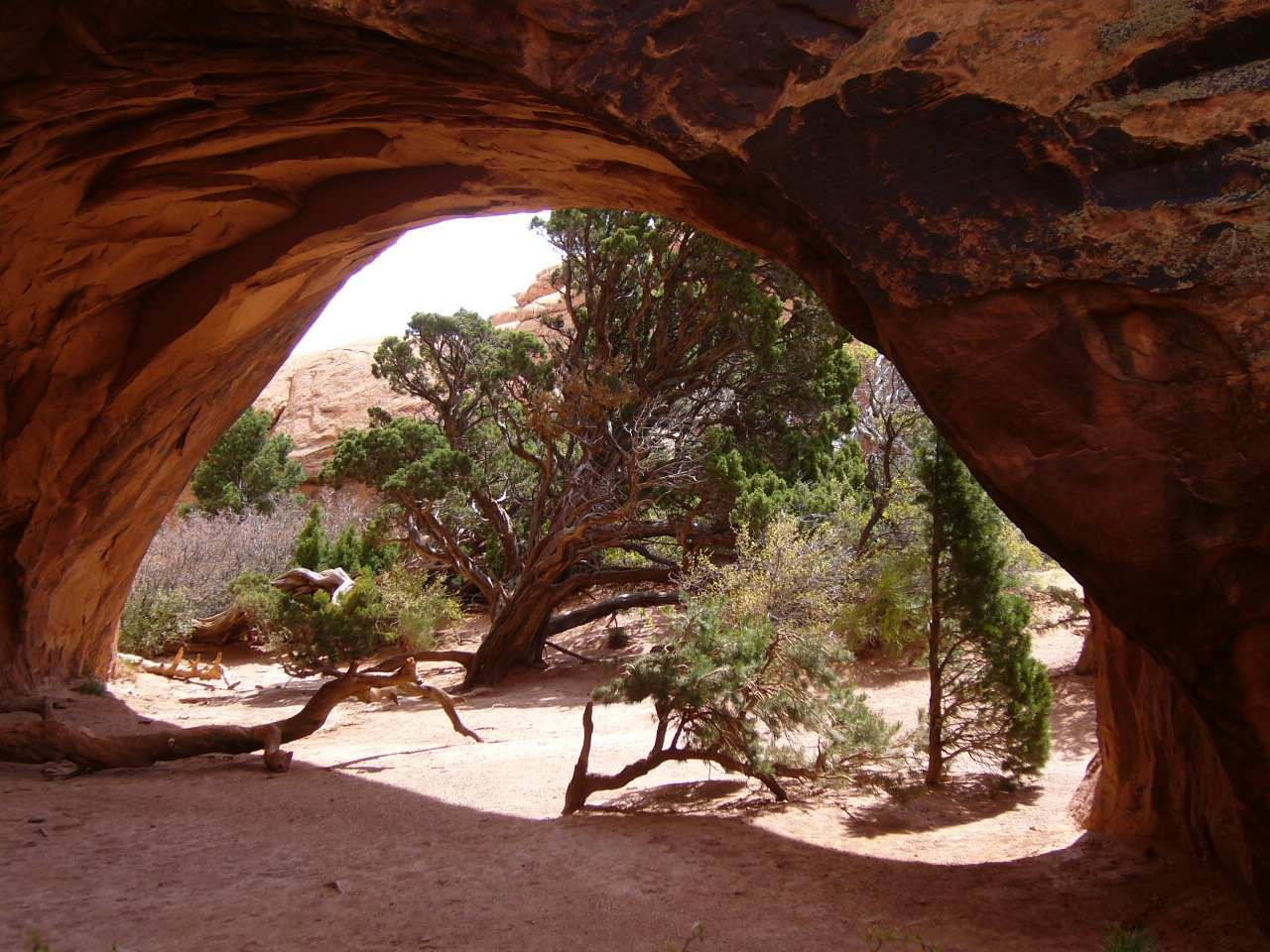
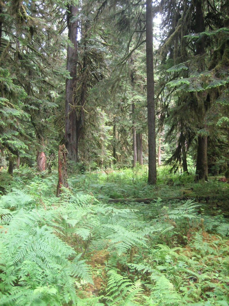
 The Quinault Rain Forest is absolutely stunning. It may be cliched
, but this place felt alien and magical, like this was the land that time forgot ... or something equally cheesy yet
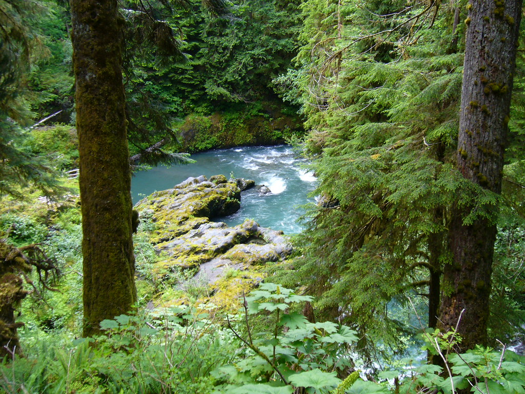
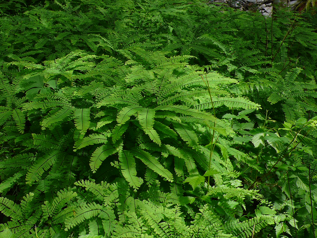
completely awe-inspiring. Having just moved to the East Coast last summer, I thought I was familiar with green, but this place blew me away. Along an ice-blue and white river, ground to tree-top there was green and brown life, green and brown mosses draped everything, hundreds of ferns hovered just off the ground creating a gorgeous green under canopy and trees of every description crowded our view.
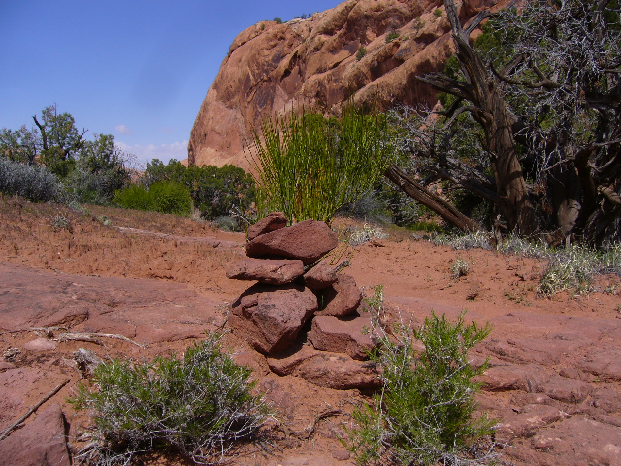
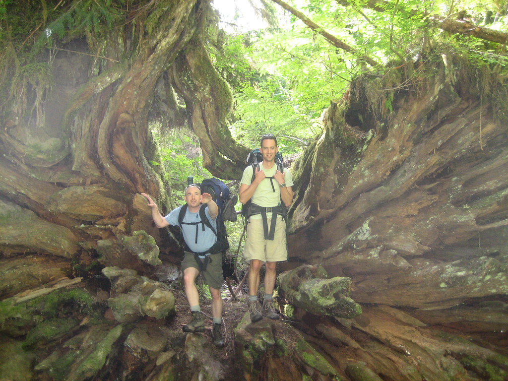
 Hike started crossing Graves Creek, straight up a fire road
 for about 2 miles, then down along the river and across the Quinault at the Pony

Creek campground. Although we were all fresh, it was slow going because we kept stopping to take pictures of the jaw-dropping beauty all around us. It kind of defies description, but these pictures might give some inkling as to what we were staring at as we walked. The ranger we had spoken to said the trail to Pyrites Creek, where we would camp the first night, was about 9.5 miles and pretty much flat. The ranger we had spoken to was full of shit. The trail was not particularly difficult, but could in no way be described as flat. You might say it was full of
relatively shallow oscillations ... but clearly not flat. The first six miles to O'Neill
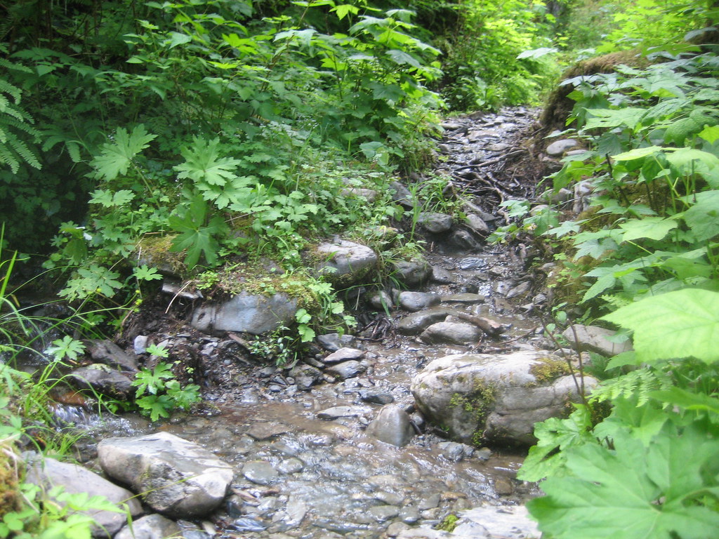
Creek were up and down, wet and muddy but very pleasant, winding through moss covered hemlock and alder along and away from the banks of the
Quinault river. After O'Neill the trail closed in on the river and we walked along the bank for some time, getting occasional unimpeded looks out on the river and the mountains beyond.
 Grimy and sweaty, we rolled into Pyrites Creek
 around 5 pm. The campsite was on the shore of the river, separated from the water by a beautiful stand of birch trees. True to my declarations and much to the amusement of everyone else, I immediately went swimming in the river, which both refreshed me and damaged the circulation in my extremities. Snow melt is cold. After everyone finished washing their feet and laughing at me, we set up camp and started dinner, which was delicious ... pasta, fresh bread and two bottles of wine. We severely overestimated the amount of pasta we would need, particularly since we had so much other food (2.5 pounds of jerky, 2.5 pounds of dried fruit ... ridiculous) and Neal stepped huge and finished the extra half pound so we did not have to pack it out. We hung out until i
t got dark around 1030 drinking wine and whisky, then crashed, got up around 8 am, ate some oatmeal and set out for the short (3.5 mile) hike up to Enchanted Valley.
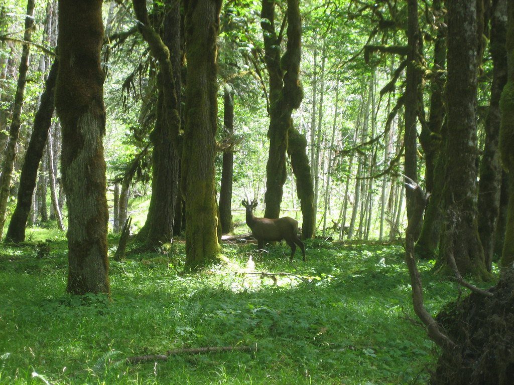
Just a bit past Pyrites creek Dave stopped us suddenly and we stood and gawked at a large Elk about 100 feet away in the woods. It paralleled us for a little while so we were never able to get closer to it, and made me wish heartily for a telephoto lens. Soon it bounded away, and we were again left alone to marvel at the huge, moss covered trees surrounding us. Then, maybe 45 minutes later, Dave was walking about 15 feet ahead of us and we heard him shout, "Bear!".
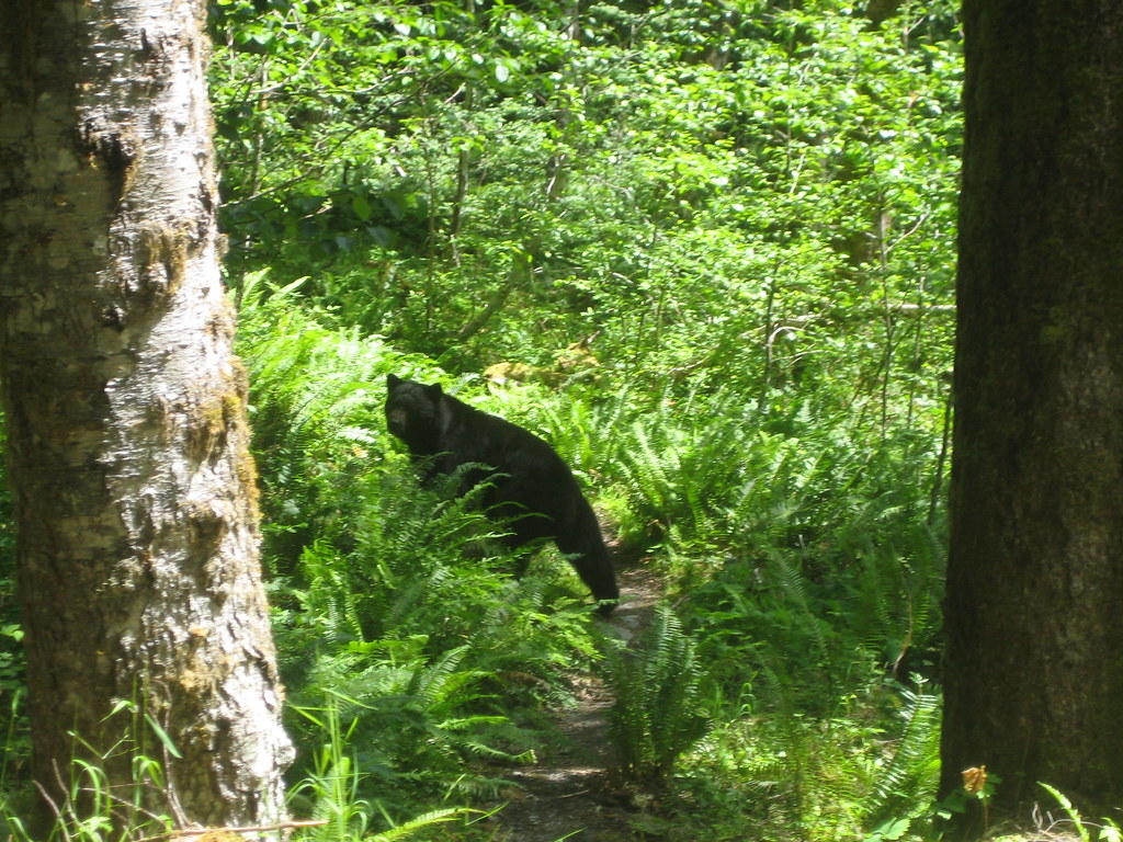 We hustled up the path over a slight rise to where Dave was standing and saw a mid-size black bear
 just sitting in the center of the trail, no more than 15 feet away. He was just minding his own business and when we all got there he started to move off into the woods. Being idiots, Neal, Dave and particularly I all got closer to take pictures, while Matt is standing in the background banging his hiking poles together and saying, "Uh guys. That's a bear. We need to scare it away not get close to it."
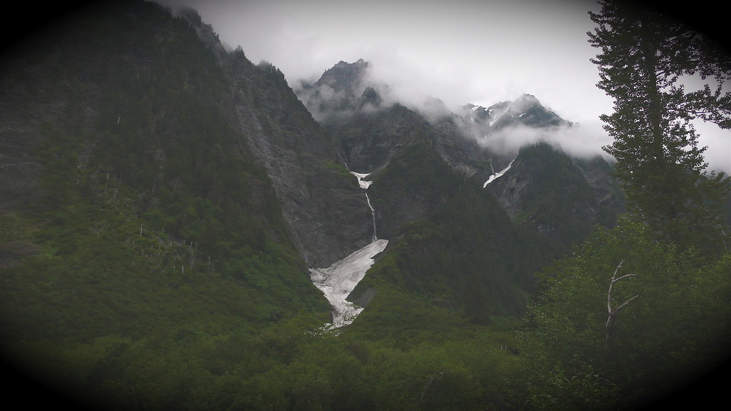
Matt was right, but it was a non-issue as the bear simply walked away into the woods. Soon afterwards we got to the gate to Enchanted Valley, a simple wooden structure clearly meant to keep the unicorns and elves in. Just after this gate we got our first glimpse of the snow-capped
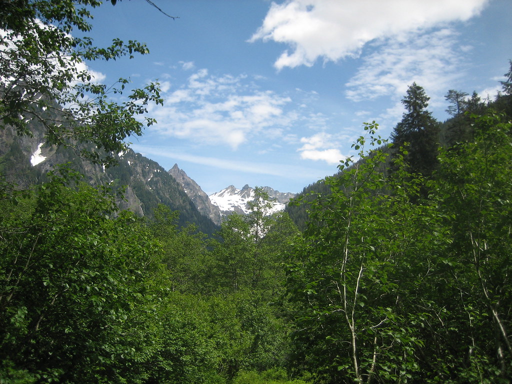
peaks crowning the valleys northern end , and then we started down into the valley itself, crossing a one-sided bridge

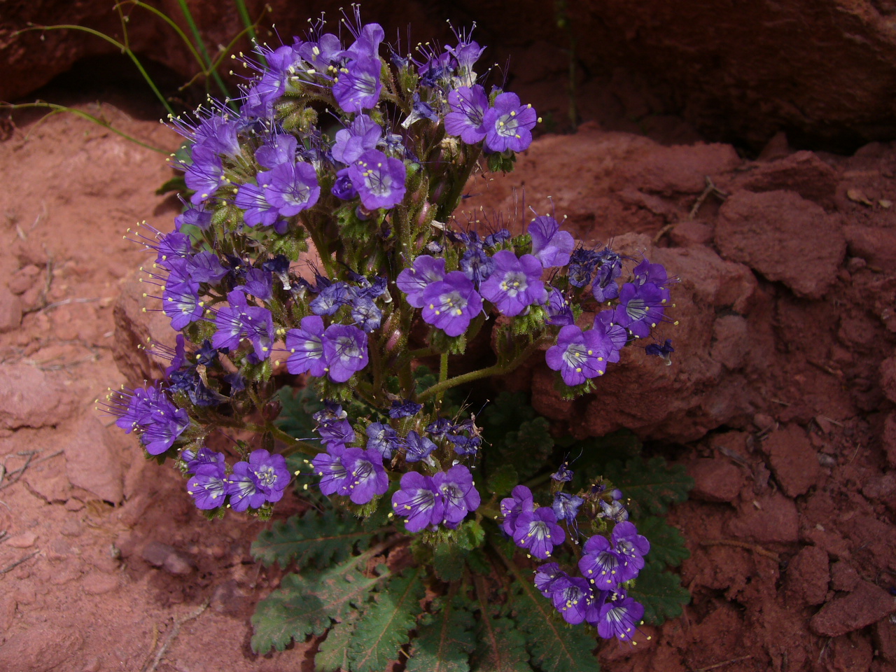
and making our way back across a shallower, rocky section of the river to to the open ground. The views we breathtaking, walls over a thousand feet high towered on either side of us, steep rock walls covered with green, only broken up by the myriad of waterfalls made by the snow melt carving its way down the cliff face. Thick, tall foliage lined the eastern side of the valley with trees crawling up the mountainsides, while the on the

western side the vegetation was more open, with lower trees and scrubs and wetland plants, with the river running in between them. Scattered about are wild flowers of all types, not in large patches but spread out like treasures in the greenery. I know that Neal is going to have a field day.
 We checked out the rangers chalet at the base of the valley, got our bearings
 and set up camp in a campsite at the northern end of the valley. Lunch was quick (we had already been gorging on jerky and dried fruit) and after we had

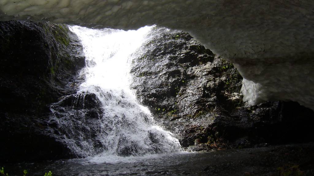
hung up our bear bags we were off to check out the ice caves we had seen in the snow patches on the mountainside to the west.
Getting to the ice caves was required crossing the river and pushing through a fairly thick swampy area, but the caves were well worth it. Huge sections of snow had been washed away by water running
down the mountains to join up with the river.
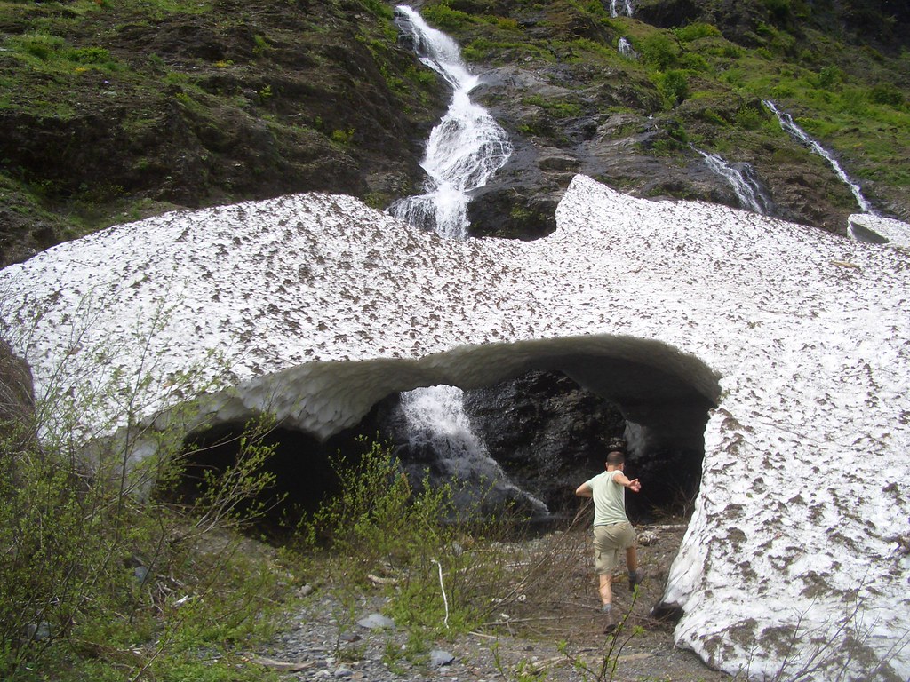
The first cave was huge and very open, and as we bounded through we saw the waterfall that had carved it out running strong down the mountainside that made up the back wall. We separated a bit before we met up at the second cave, but Dave, Matt and myself all bonded over the mass of stinging nettles we walked through to get there (Neal, who can identify nettles and was leading the way, did not deign to notice the nasty plants because we was wearing long pants).
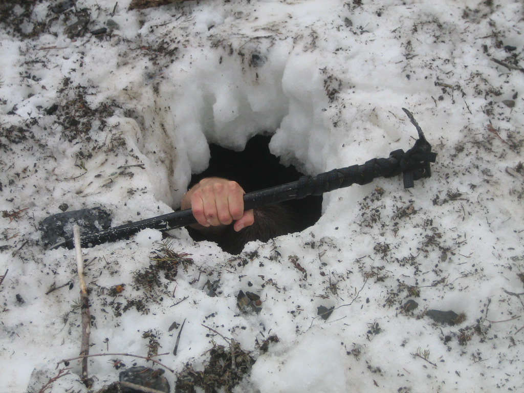
The second cave was up the cliff, so that looking out you could see the whole valley. In this cave
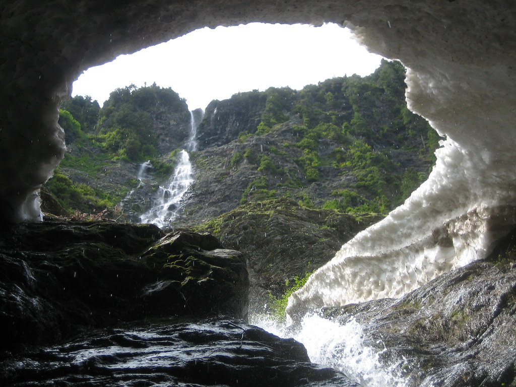
the water had carved a 200 foot tunnel down the face of the mountain, so climbing through to see the waterfall at the top was really fun ... scrambling up wet rocks and muddy scree avoiding the freezing water to get a unique, close-up view of the waterfall at the top. It was beautiful, looking from the dark, wet, muddy cave up onto the clean, pure water cascading down the green hillside.
From that cave we decided to cross what seemed like a small rise covered with slide alder to get over to a little tongue of glacier we had seen from camp. This proved to be far more difficult than we had suspected it would be , and we ended up essentially walking in the trees for about a quarter of a mile, topping them like

birds to get our bearings and escape from the incredibly dense
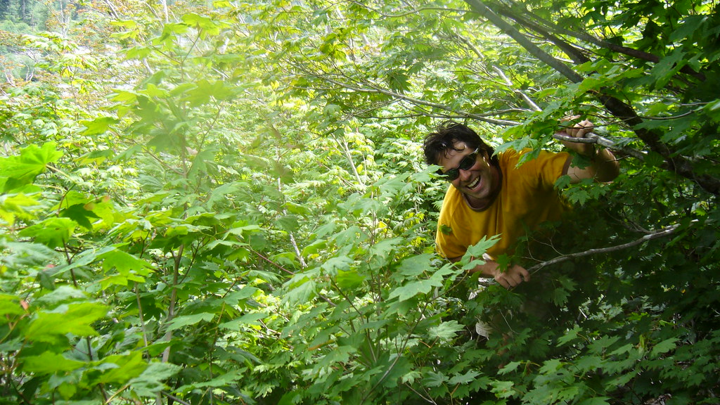
vegetation. We finally emerged, scratched up and bruised but having a fantastic time, right beneath the snow field, which contained a third ice cave that seemed to pass directly under the center of the snow field.
Neal and Dave explored the cave while Matt and I appreciated the natural air conditioning and the spectacular view. The explorers came out, very cold, after about 20 minutes, and then Neal,
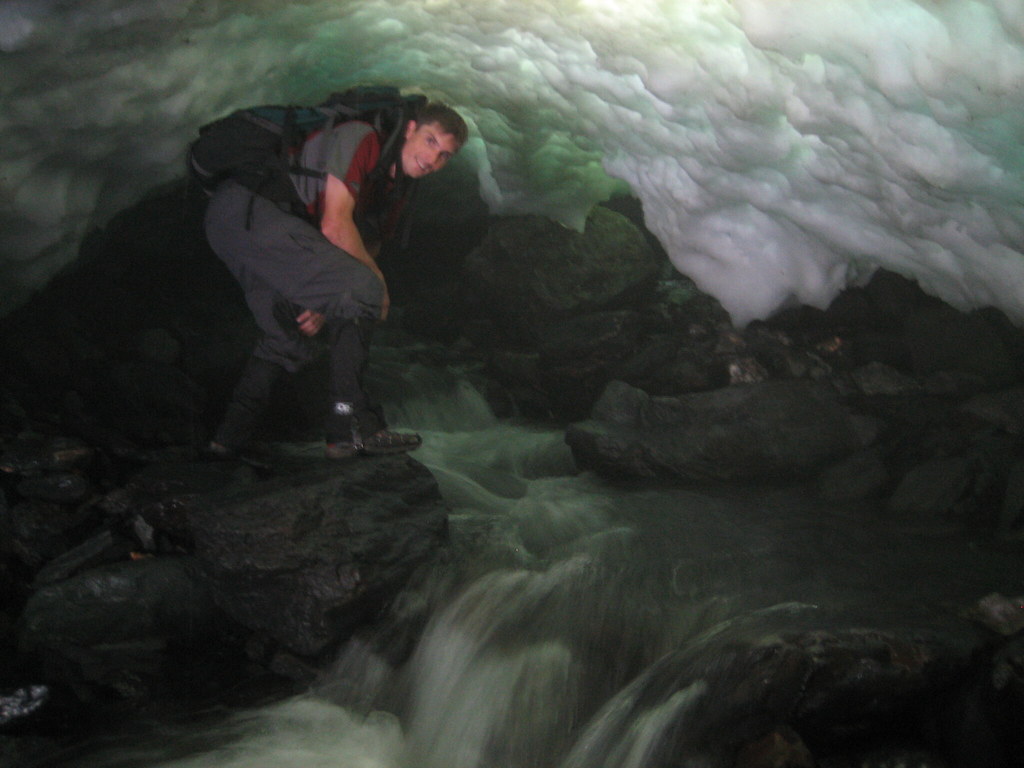
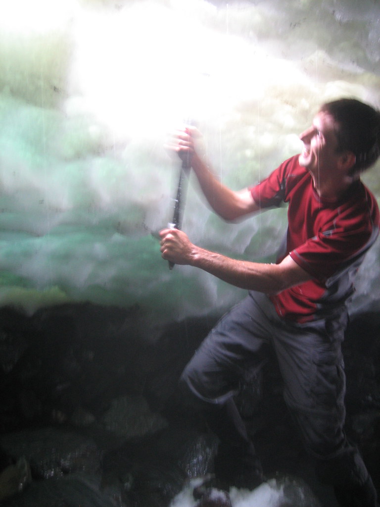
who had brought his ice axe and crampons
because he is crazy, decided to create a new exit through the roof of the cave. Although I think only crazy Neal could find this process fun, watching him provided the rest of us with great entertainment, especially when we threw snow balls at him from on top while he was in the cave. At this point we were all pretty beat, except for Neal,
who is superhuman according to the park ranger at Grand Tetons. Dave, Matt and I forded the river and trekked back to camp. We hung out reading, eating and playing cards while Neal climbed the snow field and eventually got back to us around 630 pm, leaving his crampons on the other side of the river (something we did not find out until the next day).

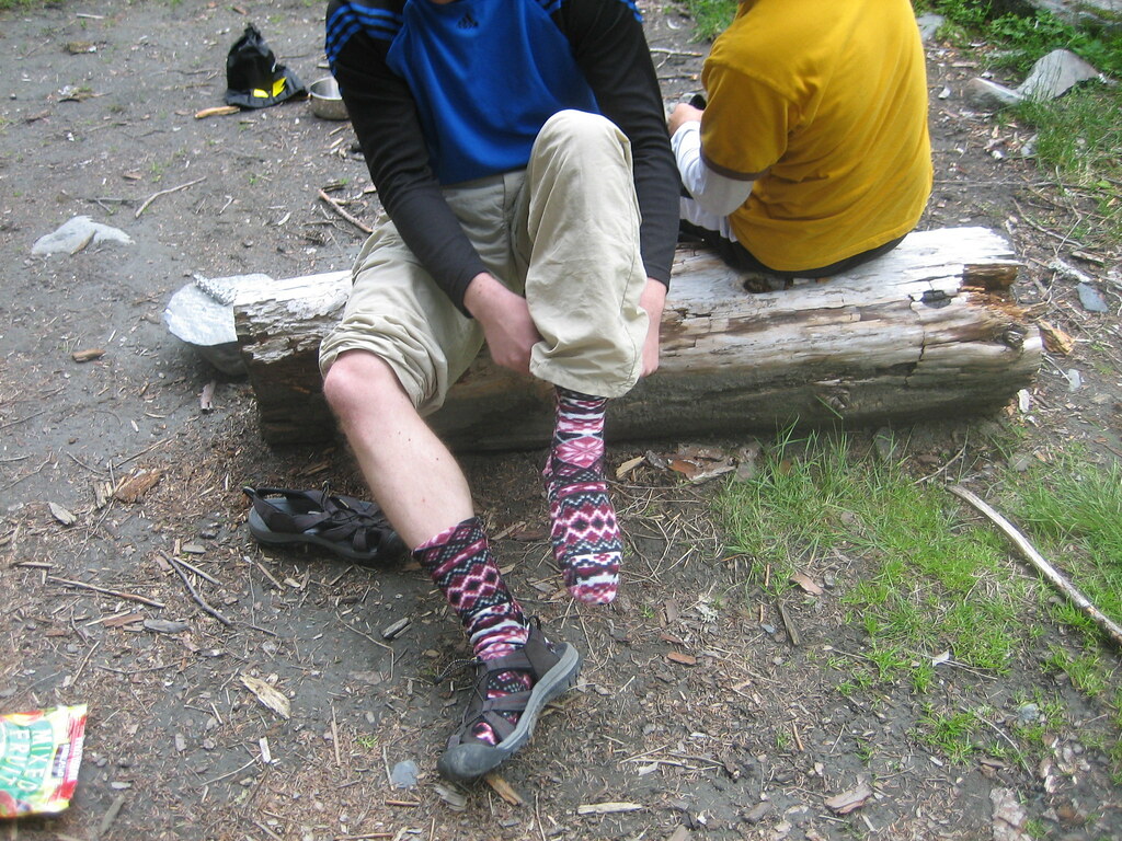 General goofing around ensued
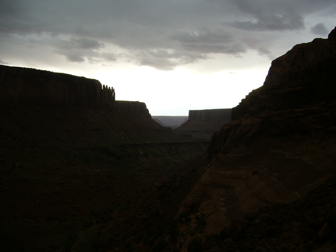
, I put on the ugliest socks in history while Neal ran around blindly as the inept yet humorous campground criminal. Dinner was a wet but surprisingly good freeze dried veggie Pad Thai, topped off by finishing the whiskey we had all been nipping at most of the day. Around 830 pm clouds started to roll across the mountains, giving the valley an air of majesty and solemnity. It was really beautiful and made me feel like we were in a different place than the one we had set up camp in that afternoon. Clouds are fast becoming one of my favorite natural phenomena, they can rapidly transform a place, give it an image of mystery that moments before you would not have imagined it could possess.
 After gawking at the scenery, we all crashed out. I woke the next morning
 to Neal yelling and shaking the tent, but did not come about for a bit. This turned out to be very lucky because when I finally did emerge a deer was eating about 5 feet from the tent.
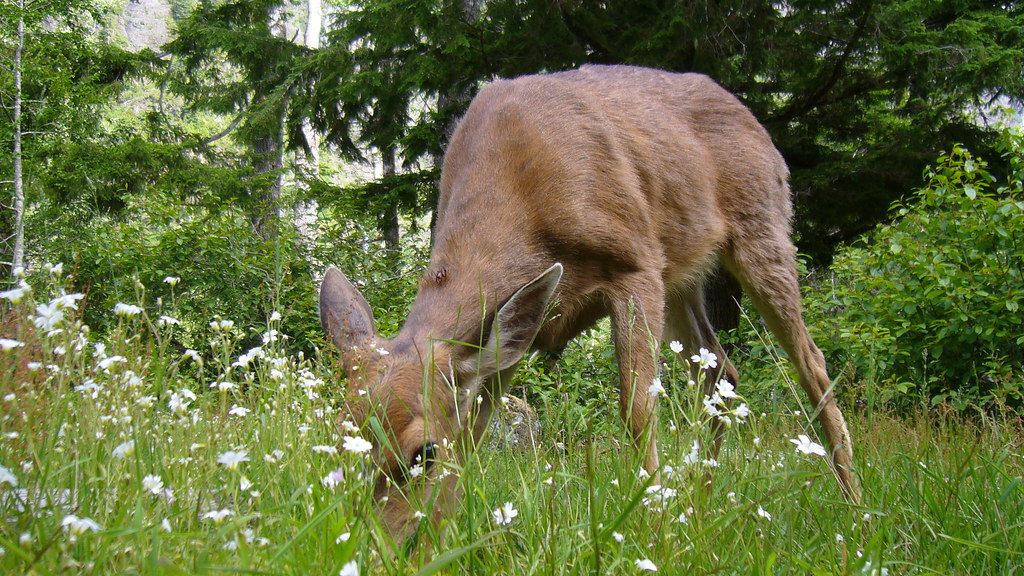
At first I was really excited and yelled to Dave and we took a bunch of photos, but then we realized the deer was basically tame and it hung out the whole time we ate breakfast. Matt, alas, never saw the deer as he was stuck at the pit toilet waiting for Neal to bring him toilet paper. Meanwhile, Neal was taking pictures of the deer.
 After breakfast, Matt took a short hike up toward Anderson pass while Neal, Dave and myself went hunting a waterfall
 by following a spur of the river upstream. Despite large quantities of nettles, various spiny plants and some steep terrain, we followed the stream about half a mile and saw two beautiful waterfalls. We all met back up at camp around lunchtime, packed everything up and headed out for Pony Creek camp. We kept a pretty good pace and made it back to O'Neil Creek around 345 pm. At point the blisters Dave and I had developed the previous day were completely raw, so we were just ignoring them. About 2 miles later Matt started to agitate for a hike all the way out, adding about 2.5 miles from Pony Creek Camp to the car.
Personally I was wavering, my pack was really heavy (turns out I cannot pack properly and my pack was maybe 10-12 pounds too heavy ... but hey, I got a good workout right?) and my blisters hurt. But they talk turned to dinner and the
prospect of hitting up Taco Bell in Aberdeen and my spirits were renewed. After a brief rest at Pony Creek campsite we pushed on the last 2.5 miles, back up the fire road and out to the car. Rapid unpacking was prompted by the swarms of mosquitos and soon Sassie was rolling out of the park, back towards
Aberdeen and those delicious
grilled, stuft burritos. A long, tough day, 13.5 miles (plus the morning hikes) in a little under six hours. Of course the trail was "flat" ...

 So last weekend Aviva and I went down to Florida to visit Aviva's parents, and while we were there I took a day drove to down to Everglades National Park, which has long been one of my most desired destinations. Turned out to be a lot of driving and a long day, but an absolutely fabulous trip and well worth the time, saw some incredible wildlife (like this Great Blue Heron to the right) and amazing scenery
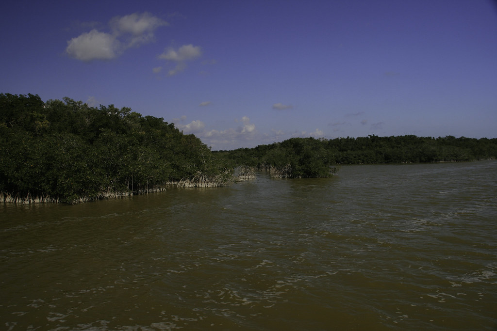 (like the Mangrove Swamps around West Lake to the left), and came away with a burning desire to go back.
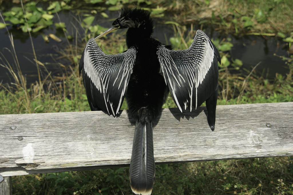 So, enjoying the drive and overcoming a bit of trouble with my sunshine pass (the turnpike automatic payment system is not as simple as the EZ pass system in New England), I made it down to Homestead and turned into the glades. It was already hot, around 78 degrees, when I left Boca, and when I got out of the car at the Ernest F. Coe visitor center it was around 85. And quite humid. After talking with one of the rangers (this was the first park I have been to where all the rangers were retirees), I decided to walk the Anhinga (the Anhinga trail was named after Anhingas, see left) and Gumbo Limbo trails by the visitor center, then drive down to Flamingo and hit as many of the walking trails as I could on the way back up to Homestead.
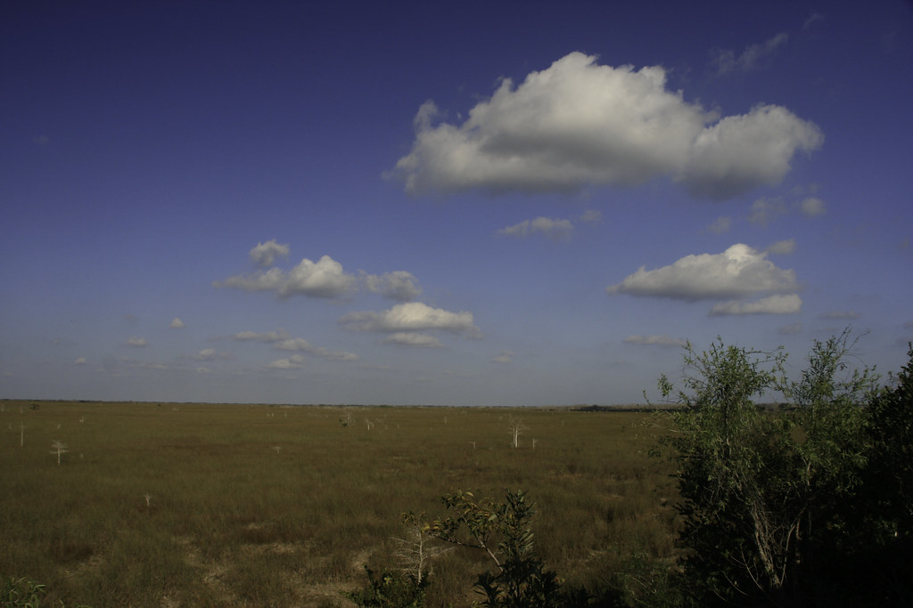 small islands of elevated ground sitting 2 or 3 feet higher than the surrounding land grow different types of vegetation due to the flooding of the saw grass ocean in the wet season. These islands are called
 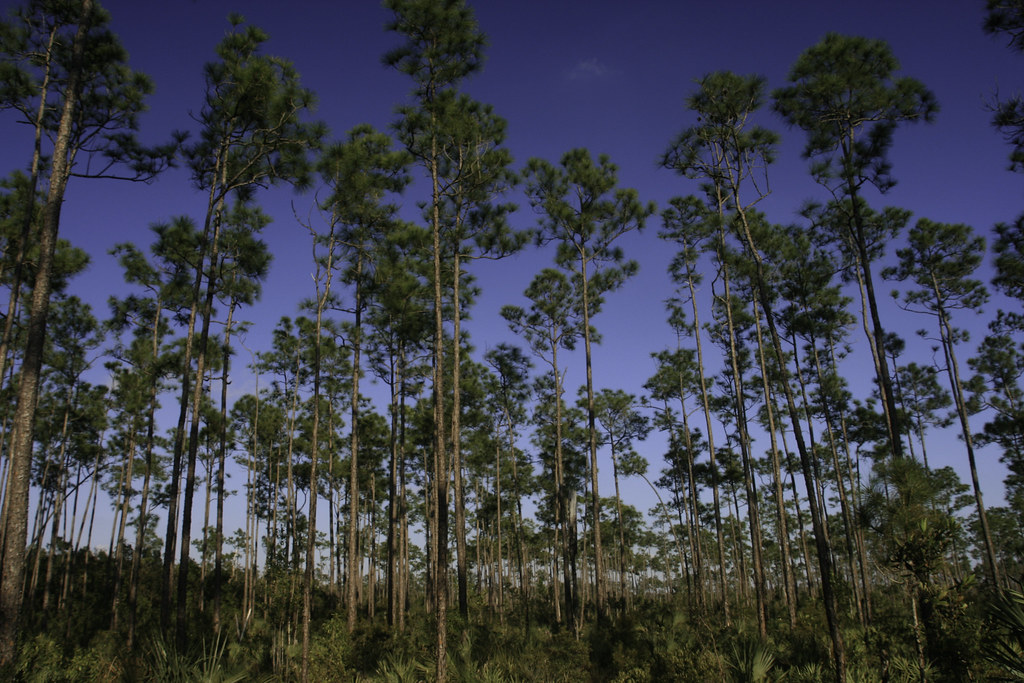 hammocks and keys, and they stand out as islands of green in a sea of brown saw grass (right) during the dry season. Most of the trails in this part of the park start on wooden bridges crossing the saw grass into hammocks covered with tropical hardwoods or slash pines (like those found on Long Pine Key, left).
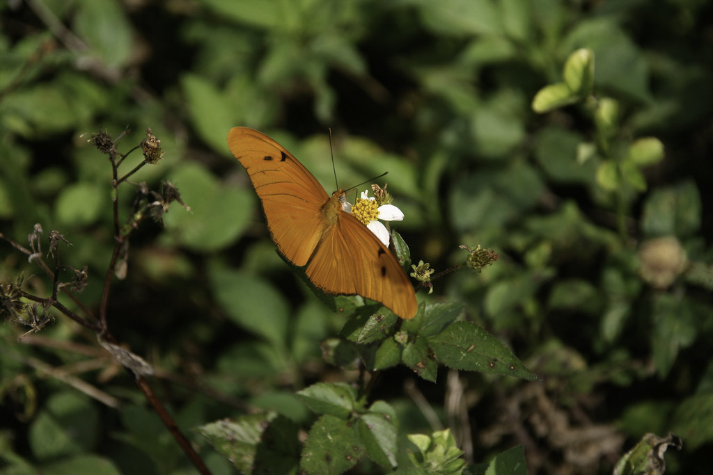 Then I got back in the car and headed back toward Boca, stopping at Christian Point Trail, Mizrak Pond, West Lake, Mahogany Hammock, and Long Pine Key. Each of these stops had a short or long trail, mostly short, teaching me about the glades and showing off different aspects of their unique ecology. A truly beautiful place, with incredible flora and fauna (like the Julia Heliconian on the right or the Florida chicken turtle, below left, or the American alligator below right).
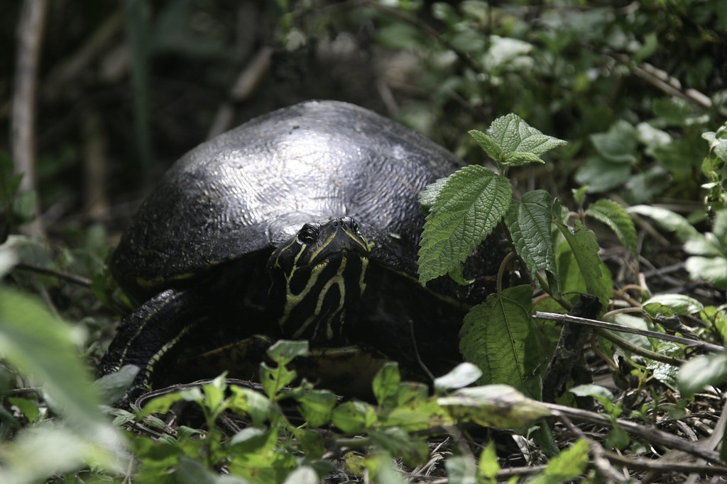 All in all it was a wonderful first trip, and I feel like I just scratched the surface of this amazing park (I mean, the place is over 1.5 million acres in size). Heading back after a long, luxurious day of hiking and photography, I left very happy but hungry for more. I guess I will have to go back :)